|
|
Bio - Eric L. Mihelbergel is an intermediate/advanced windsurfer, kiteboarder, and foiler living in the Great Lakes Region of New York State who enjoys sharing about windsports and fitness.
|
The WNY Wind Report
I am not a professional meteorologist. Do NOT rely on any of this information without consulting a professional meteorologist. Always use extreme caution with all weather events. The information below is for entertainment purposes only.
These wind reports/forecasts will generally be written for days when the wind is expected to be 15-20mph or greater (and air temp above 40 degrees), unless I have other obligations in which case a report may not be written at all. If you enjoy riding on days with less than 15mph of wind, or if I am otherwise unable to post a report/forecast, you may find this article helpful in analyzing the weather "Weather Forecasting For Wind Driven Water Sports in WNY" and this video series "Predicting Wind". Accuracy of my reports/forecasts was analyzed in the 2018 season and can be viewed by clicking here. And, remember, you don't need wind everywhere to get a great session. You only need wind at one beach for one hour to score a GREAT session!!! Find it! Get it! Score!
|
Probability High = 67-99% chance Moderate = 34-66% chance Low Probability = 1-33% chance |
|
Probability High = 67-99% chance Moderate = 34-66% chance Low Probability = 1-33% chance |
|
|
Closed For The Season
See You Next Year
See You Next Year
Forecast for Sunday, November 29:
(Written Saturday, November 28, 4pm)
A small low pressure system moving in on Sunday. Look for SW wind 20-35mph with some sun and warmer temps. This is a high probability event.
(Written Saturday, November 28, 4pm)
A small low pressure system moving in on Sunday. Look for SW wind 20-35mph with some sun and warmer temps. This is a high probability event.
Forecast for Saturday, November 28:
(Written Saturday, November 28, 9am)
Low pressure to the north and high pressure to the south. A nice gradient! Look for WSW in the afternoon 20-30mph with sun. This is a high probability event.
(Written Saturday, November 28, 9am)
Low pressure to the north and high pressure to the south. A nice gradient! Look for WSW in the afternoon 20-30mph with sun. This is a high probability event.
Forecast for Friday, November 27:
(Written Thursday, November 26, 5pm)
A bit of a pressure gradient remains. Look for 15-20mph WSW in the afternoon on Friday. This is a moderate probability event.
(Written Thursday, November 26, 5pm)
A bit of a pressure gradient remains. Look for 15-20mph WSW in the afternoon on Friday. This is a moderate probability event.
Forecast for Thursday, November 26:
(Written Wednesday, November 25, 11am)
A bit of a pressure gradient in the GLR will bring some wind for Thanksgiving Day. Look for 20-30mph WSW starting in late morning and continuing for the rest of the day. This is a high probability event.
(Written Wednesday, November 25, 11am)
A bit of a pressure gradient in the GLR will bring some wind for Thanksgiving Day. Look for 20-30mph WSW starting in late morning and continuing for the rest of the day. This is a high probability event.
Forecast for Wednesday, November 25:
(Written Tuesday, November 24, 10am)
Low pressure approaches from the west as high pressure exits to the east. This sets up some south wind for Wednesday with slightly warmer air temps. Look for 15-20mph S wind on eastern Lake Erie in the morning, and possibly 15-25mph S wind in the Finger Lakes Region. This is a moderate probability event.
Forecast for Monday, November 23:
(Written Monday, November 23, 9:30am)
Low pressure to the east and high pressure to the west. This may give us W wind 15-25mph in the afternoon with air temps just over 40 degrees. This is a high probability event.
(Written Monday, November 23, 9:30am)
Low pressure to the east and high pressure to the west. This may give us W wind 15-25mph in the afternoon with air temps just over 40 degrees. This is a high probability event.
Forecast for Friday, November 20:
(Written Thursday, November 19, 10am)
The low pressure will roll east as high pressure fills in behind it, which is typical for these systems. This is what gives us the second day of wind on Friday. Winds will begin to veer more SW or WSW on Friday, so there should be a better fetch on eastern Lake Erie. Look for 20-40mph SW or WSW most of the day on Friday with air temps in the 50's and partly cloudy skies. This is a high probability event.
Forecast for Thursday, November 19:
(Written Wednesday, November 18, 1pm)
Low pressure moving across Canada and high pressure to our south. A nice set-up with a steep pressure gradient. This system will give us a 2 day wind event with warmer air temps. On Thursday look for mostly SSW winds 20-45mph on eastern Lake Erie. Wind may veer more SW in the afternoon. But don't forget the Finger Lakes Region where you might find S wind 20-40mph. This is a high probability event.
Forecast for Monday, November 16:
(Written Sunday, November 15, 10am)
The low pressure moves east as high pressure comes in. Winds will continue to blow strong on Monday while air temps drop to the low 40's. Look for WSW wind 25-40mph most of the day. This is a high probability event.
(Written Sunday, November 15, 10am)
The low pressure moves east as high pressure comes in. Winds will continue to blow strong on Monday while air temps drop to the low 40's. Look for WSW wind 25-40mph most of the day. This is a high probability event.
Forecast for Sunday, November 15:
(Written Saturday, November 14, 11am)
A huge intense low pressure system is approaching the GLR. Most of Sunday will likely be too big to ride. Things will start out south as the typical warm front comes through in the late morning. Winds will likely be 25-45mph S in the morning on Lake Erie. Maybe the Canadian crew can take advantage of this before things get out of hand. As the cold front approaches and wind begins to veer SW in the afternoon the magnitude will increase to 40-60mph SW. The Finger Lakes may be an option for south wind. However, magnitude looks too big in the morning with 30-60mph S wind. Afternoon may present the possibility of rideable wind. Be very careful if you venture out! Things can change quickly and without warning. Monday looks more reasonable. This is a high probability event.
Forecast for Friday, November 13:
(Written Thursday, November 12, 12noon)
A bit of a pressure gradient will develop Friday afternoon. Keep an eye on the meters, and look for 15-25mph WSW wind after 12noon on Friday. This is a high probability event.
(Written Thursday, November 12, 12noon)
A bit of a pressure gradient will develop Friday afternoon. Keep an eye on the meters, and look for 15-25mph WSW wind after 12noon on Friday. This is a high probability event.
Forecast for Wednesday, November 11:
(Written Tuesday, November 10, 9am)
Low pressure moves into the GLR from the mid-west, and with it comes a bit of a cold front. The cold front should arrive around 10am, but you might want to be ready to go by 8am just in case direction turns favorable that early. Look for 15-30mph SW sometime between 8am-4pm. This is a high probability event.
Forecast for Saturday, November 7:
(Written Friday, November 6, 3pm)
Very stubborn high pressure will stay put to our south while it blocks low pressure from moving in from the west. But this keeps a pressure gradient over the GLR for Saturday. Look for WSW 15-25mph between 10am-3pm.
(Written Friday, November 6, 3pm)
Very stubborn high pressure will stay put to our south while it blocks low pressure from moving in from the west. But this keeps a pressure gradient over the GLR for Saturday. Look for WSW 15-25mph between 10am-3pm.
Forecast for Friday, November 6:
(Written Thursday, November 5, 3pm)
Another low pressure system in Canada coupled with high pressure in the southern USA gives us yet another nice pressure gradient. Wind direction should be better as it veers from SSW to SW or even WSW, but bubbling is still an issue for Friday. Look for 15-25mph SW or WSW most of the day.
Forecast for Thursday, November 5:
(Written Wednesday, November 4, 9:30am)
The low pressure system is swinging across Canada, and we will continue to get a pressure gradient in the GLR. However, air temps look to continue to be very warm, so bubbling will again be a big issue. Look for 15-30mph SSW wind most of the day on Thursday. This is a moderate probability event.
Forecast for Wednesday, November 4:
(Written Tuesday, November 3, 3pm)
High pressure to the east and low pressure moving across Canada. Sets up a nice gradient. This will also pull some warmer air up from the south. On Wednesday look for SSW wind 15-30mph for most of the day. There is a strong chance of some bubbling with the warmer temps. This is a moderate probability event.
Forecast for Tuesday, November 3:
(Written Monday, November 2, 9:30pm)
Higher pressure moves into the region. We may see 15-20mph WSW between 3pm-sunset. Air temps in the 40's. This is a moderate probability event.
(Written Monday, November 2, 9:30pm)
Higher pressure moves into the region. We may see 15-20mph WSW between 3pm-sunset. Air temps in the 40's. This is a moderate probability event.
Forecast for Monday, November 2;
(Written Monday, November 2, 11am)
What a day on Sunday! Perfect 40-45mph wind, a little sun, and decent air temps. Today we will see the low pressure move out to our northeast. But, with high pressure moving in, we will still have a steep pressure gradient. The issue, however, is air temp. It may not get above 40 degrees. However, expect afternoon winds 25-50mph WSW. This is a high probability event.
Forecast for Sunday, November 1:
(Written Saturday, October 31, 11am)
Happy Halloween! The beginning of November is upon us. So far this season has delivered 177 sessions on average windsurf sail size 4.9m (not counting foil sessions). We have a spooky low pressure system headed to the GLR for Sunday. Currently it is moving across Canada and will impact the WNY area with some big wind. Wind will start out south as is typical for these systems. There is a significant cold front associated with this one, and it will be important to follow that front closely on Sunday as you decide what time and location you will ride. There will likely be a line of showers with this cold front, so watch for that on the radar. You may see that around 10am-12noon. Wind direction may veer quickly from S to WSW or W as the front goes through, so be ready. Air temps may drop quickly. If you want the warmest temps then be ready to ride as soon as the front arrives and wind veers WSW or W. Air temps look to be a little warmer on Lake Ontario, so keep that as an option especially if the wind is W. We will probably see something like 25-40mph WSW or W after 12noon. This is a high probability event.
Forecast for Thursday, October 29:
(Written Wednesday, October 28, 10am)
As low pressure moves in from the south we will see winds change direction on Thursday. Look for 15-30mph ENE after 12noon on Thursday. This is a high probability event.
(Written Wednesday, October 28, 10am)
As low pressure moves in from the south we will see winds change direction on Thursday. Look for 15-30mph ENE after 12noon on Thursday. This is a high probability event.
Forecast for Wednesday, October 28:
(Written Tuesday, October 27, 11am)
A deep low pressure system is moving across Canada centering on the Hudson Bay area. This will extend a nice pressure gradient into the GLR on Wednesday. There will not be cold front in the WNY area, but I think we will still see promising winds after 12noon on eastern Lake Erie. Perhaps some sun as well. Look for 20-35mph WSW wind from 12noon until sunset. This is a high probability event.
Forecast for Tuesday, October 27:
(Written Tuesday, October 27, 10:30am)
There is a small chance that we will see 15-20mph W wind on the eastern end of Lake Erie between 4pm and sunset today. This is a low probability event.
(Written Tuesday, October 27, 10:30am)
There is a small chance that we will see 15-20mph W wind on the eastern end of Lake Erie between 4pm and sunset today. This is a low probability event.
Forecast for Sunday, October 25:
(Written Saturday, October 24, 9pm)
A bit of a pressure gradient on Sunday may be enough for a good session. Look for ENE wind 15-20mph+ on Lake Ontario after 12noon, and probably similar conditions on Lake Erie near the PA line. This is a moderate probability event.
(Written Saturday, October 24, 9pm)
A bit of a pressure gradient on Sunday may be enough for a good session. Look for ENE wind 15-20mph+ on Lake Ontario after 12noon, and probably similar conditions on Lake Erie near the PA line. This is a moderate probability event.
Forecast for Saturday, October 24:
(Written Friday, October 23, 9:30am)
The low pressure moves out of the region with high pressure right behind it bringing a typical NW wind. There will be more wind in the morning. In the Rochester area we may see 20-25mph+ NW before noon, while on Lake Erie is more likely to be in the 10-15mph WNW range. Much colder air temps. This is a moderate probability event.
Forecast for Friday, October 23:
(Written Thursday, October 22, 9:30am)
Low pressure moving into the GLR will bring south wind on Friday. Air temps are gonna be warm so be prepared for gusty conditions. Look for 15-25mph S wind most of the day. This is a moderate probability event.
(Written Thursday, October 22, 9:30am)
Low pressure moving into the GLR will bring south wind on Friday. Air temps are gonna be warm so be prepared for gusty conditions. Look for 15-25mph S wind most of the day. This is a moderate probability event.
Forecast for Wednesday, October 21:
(Written Tuesday, October 20, 9:30am)
Another low pressure system moving across the GLR on Wednesday. Warm front coming through in the morning and cold front in early afternoon. Looks like some rain as the cold front approaches, but hopefully tapering off after 1pm. Look for winds to start off SSW in the morning then veering WSW after 12noon 20-30mph+. This is a moderate probability event.
Forecast for Monday, October 19:
(Written Monday, October 18, 7:30am)
It is not a great set-up for today, but there is a small possibility that we may see 15-20mph ENE near the PA line in the afternoon. This is a low probability event.
(Written Monday, October 18, 7:30am)
It is not a great set-up for today, but there is a small possibility that we may see 15-20mph ENE near the PA line in the afternoon. This is a low probability event.
Forecast for Sunday, October 18:
(Written Saturday, October 17, 8pm)
That low pressure bounces up into Ontario pretty quick. We get a nice pressure gradient. It's gonna deliver south wind, so turn all eyes toward the Finger Lakes. As of now, I would suggest getting there by 11am Sunday. Wind looks to be 20-30mph S in the FLR sometime between 11am-5pm. Get it Good!!! This is a high probability event.
Forecast for Saturday, October 17:
(Written Friday, October 16, 2pm)
High pressure moving up from the south and low pressure in the mid-west. A tasty little pressure gradient for Saturday. Look for 20-30mph WSW sometime between 11am-5pm. This is a high probability event.
(Written Friday, October 16, 2pm)
High pressure moving up from the south and low pressure in the mid-west. A tasty little pressure gradient for Saturday. Look for 20-30mph WSW sometime between 11am-5pm. This is a high probability event.
Forecast for Friday, October 16:
(Written Thursday, October 15, 5:30pm)
High pressure moves in on Friday as low pressure exits. We may see 15-20mph WSW in the afternoon on Friday. This is a moderate probability event.
(Written Thursday, October 15, 5:30pm)
High pressure moves in on Friday as low pressure exits. We may see 15-20mph WSW in the afternoon on Friday. This is a moderate probability event.
Forecast for Thursday, October 15:
(Written Wednesday, October 14, 2pm)
A beautiful low pressure system will move into Ontario on Thursday producing a strong pressure gradient over the GLR. A cold front will arrive in the Buffalo area sometime around 12noon. As per usual with these low pressure systems, things will start out SSW and veer WSW. Most of the models are showing that wind direction should start to turn WSW by 12noon as the front approaches and moves through. Look for 20-40mph WSW sometime between 11am-sunset. Watch meters upwind from Buffalo in the morning to see how the system behaves and how other locations respond. This is a high probability event.
Forecast for Tuesday, October 13:
(Written Monday, October 12, 1:30pm)
A huge low pressure system pushes across Canada, while a bit of high pressure remains to our south. That sets up a decent pressure gradient for Tuesday that may give us 15-25mph WSW on eastern Lake Erie in the afternoon. This is a high probability event.
(Written Monday, October 12, 1:30pm)
A huge low pressure system pushes across Canada, while a bit of high pressure remains to our south. That sets up a decent pressure gradient for Tuesday that may give us 15-25mph WSW on eastern Lake Erie in the afternoon. This is a high probability event.
Forecast for Sunday, October 11:
(Written Saturday, October 10, 5:30pm)
High pressure in Canada pushes out the low that sat over Hudson Bay, while the remnants of Delta move northeast. This give a pressure gradient for Sunday FUNDAY!!! Gonna be cooler, but both Lake Erie and Lake Ontario may see 20-25mph+ ENE most of the day. This is a high probability event.
Forecast for Saturday, October 10:
(Written Friday, October 9, 3:30pm)
Again, low pressure is moving across the Hudson Bay region in Canada, and it will push out high pressure, leaving a gradient over the GLR on Saturday. A warm front is coming through the GLR now, but there will be no cold front until late Saturday. Things will start out SSW in the morning on Saturday and veer WSW by afternoon. There is a chance that the warmer temps will cause some bubbling, so beware. Look for SSW veering WSW 20-40mph on eastern Lake Erie with diminishing winds after 4pm. This is a moderate probability event.
Forecast for Thursday, October 8:
(Written Wednesday, October 7, 9am)
Low pressure is exiting the region to the east and high pressure enters from the west. Things will start out WNW in the morning, but by late afternoon we may see wind back to WSW. Keep an eye open for 15-20WSW sometime between 3pm and sunset. This is a high probability event.
Forecast for Wednesday, October 7:
(Written Tuesday, October 6, 8pm)
That low pressure over Hudson Bay is going to continue, AND it will morph into MORE LOW PRESSURE in the form of a trough over the GLR. Nice! So, what does it mean? Winds will start out WSW in the morning with some rain showers ahead of the cold front. As the cold front comes through, around 10am, things will start to veer W and then WNW later. Winds could reach 45mph WSW as the cold front approaches. I would generally wait until after you see the rain showers pass before you ride, but be ready. Watch the radar and the meters!!! Overall, look for WSW winds veering W 25-45mph sometime between 8am-3pm, then W or WNW 20-30mph until dark. This is a high probability event.
Forecast for Tuesday, October 6:
(Written Monday, October 5)
We have deep low pressure centering on the Hudson Bay area which will extend a nice pressure gradient over the GLR for Tuesday and Wednesday. Things will start out SSW on Tuesday and then veer and remain SW for most of the day. Air temps will warm into the 60's by afternoon with some sun. Look for 20-30mph SW winds on eastern Lake Erie most of the day. This is a high probability event.
(Updated Tuesday, 9am: About half the models are showing that wind could stay south most of the day on the south side of eastern Lake Erie. The north side of Lake Erie looks better for WSW at this point. Keep an eye on the meters.)
Forecast for Saturday, October 3:
(Written Saturday, October3, 12noon)
Not much of a gradient today, but possible 15-20mph WSW on eastern Lake Erie after 4pm. This is a low probability event.
(Written Saturday, October3, 12noon)
Not much of a gradient today, but possible 15-20mph WSW on eastern Lake Erie after 4pm. This is a low probability event.
Forecast for Friday, October 2:
(Written Thursday, October 1, 12noon)
High pressure moving in to the GLR from the west. We get a nice little gradient on Friday. Look for 15-20mph WSW in the afternoon on eastern Lake Erie. With cool air temps, however, there is potential for lake effect rain which could mess up the wind. With that in mind. This is a moderate probability wind event.
Forecast for Thursday, October 1:
(Written Wednesday, September 30, 10:30am)
The low is moving off to the east, but with high pressure filling in right behind it we will continue to see a pressure gradient. Look for 15-25mph WSW most of the day on the eastern end of Lake Erie. This is a high probability event.
(Written Wednesday, September 30, 10:30am)
The low is moving off to the east, but with high pressure filling in right behind it we will continue to see a pressure gradient. Look for 15-25mph WSW most of the day on the eastern end of Lake Erie. This is a high probability event.
Forecast for Wednesday, September 30:
(Written Tuesday, September 29, 10am)
Low pressure over Ontario and Quebec gives us a steep pressure gradient in the GLR. Winds on eastern Lake Erie look to be 20-40mph WSW most of the day. This is a high probability event.
(Written Tuesday, September 29, 10am)
Low pressure over Ontario and Quebec gives us a steep pressure gradient in the GLR. Winds on eastern Lake Erie look to be 20-40mph WSW most of the day. This is a high probability event.
Forecast for Tuesday, September 29:
(Written Monday, September 28, 2pm)
Low pressure is moving across Ontario bringing a cold front with it tonight. Tuesday will have some wind. Eastern Lake Erie may see 15-25mph WSW sometime between 11am-5pm. Bring a wetsuit because it's gonna be cooler and cloudy. This is a high probability event.
(Updated Tuesday, 9:30am: Models aligning to show more in the 15-20mph WSW range today.)
Forecast for Monday, September 28:
(Written Sunday, September 27, 9:30pm)
Low pressure enters the region on Monday bringing more south wind. Today was great on Lake Erie, but if you want to ride south wind on Monday then you might need to check out the Finger Lakes. Look for 15-20mph S in the afternoon. This is a moderate probability event.
Forecast for Sunday, September 27:
(Written Saturday, September 26, 11am)
Low pressure is moving across Canada and will impact the GLR. Expect S wind on Sunday morning in the GLR veering WSW in the afternoon. The FLR will see mostly S wind. On eastern Lake Erie we may see 15-25mph WSW sometime between 12noon-5pm. The Finger Lakes may see 15-25mph S sometime between 10am-5pm. This is a moderate probability event.
Forecast for Saturday, September 26:
(Written Friday, September 25, 5:30pm)
With low pressure to our northwest and high pressure to the east we will have a pressure gradient on Saturday, but most models are not predicting much wind at the moment. I would definitely keep an eye on things though. Wind should start out south in the morning. You might catch a 15-20mph S session on Lake Erie or the Finger Lakes in the morning. And with sunny skies, you may catch a WSW session in the afternoon 15-20mph. This is a moderate probability event.
Forecast for Thursday, September 24:
(Written Thursday, September 24, 10am)
There is not much of a pressure gradient today, but a couple models are still showing some wind. I'm not too excited, but it's possible that between 12noon-6pm we could see 15-20mph WSW. This is a low probability event.
(Written Thursday, September 24, 10am)
There is not much of a pressure gradient today, but a couple models are still showing some wind. I'm not too excited, but it's possible that between 12noon-6pm we could see 15-20mph WSW. This is a low probability event.
Forecast for Wednesday, September 23:
(Written Tuesday, September 22, 10pm)
September has been incredible! Windy almost every day. Today was fantastic. And Wednesday looks just as good or better. The gradient that we had today will intensify slightly. This may give us 15-25mph WSW sometime between 2pm and sunset. This is a high probability event.
Forecast for Tuesday, September 22:
(Written Tuesday, September 22, 9am)
Separate low pressure systems to our north and east, and high pressure to our south. We see a little pressure gradient towards evening today. Look for possible 15-20mph WSW between 4pm and sunset. This is a moderate probability event.
(Written Tuesday, September 22, 9am)
Separate low pressure systems to our north and east, and high pressure to our south. We see a little pressure gradient towards evening today. Look for possible 15-20mph WSW between 4pm and sunset. This is a moderate probability event.
Forecast for Sunday, September 20:
(Written Saturday, September 19, 9pm)
High pressure still remains in the region. There will be a bit of a pressure gradient on Sunday with sunshine most of the day. This may set up some ENE on Lake Ontario in the Olcott area. Look for possible 15-20mph ENE sometime between 2-6pm. It's only moderate probability, but worth watching. It's also possible that Lake Erie will see some similar wind near the PA line.
Forecast for Friday, September 18:
(Written Thursday, September 17, 2:30pm)
High pressure continues to move south and east out of Canada and pushes the remnants of Sally off the east coast. This sets up a pressure gradient for the GLR on Friday. Both Lake Erie and Lake Ontario may see 15-20mph NE, particularly in the morning on Friday.
Forecast for Thursday, September 17:
(Written Wednesday, September 16, 5pm)
Low pressure in Canada gets pushed east by incoming high pressure, and Sally pushes up from the south. We get a bit of a pressure gradient Thursday that may produce some N wind on both Lake Erie and Lake Ontario. Look for a possibly 15-20mph N or NNE.
(Written Wednesday, September 16, 5pm)
Low pressure in Canada gets pushed east by incoming high pressure, and Sally pushes up from the south. We get a bit of a pressure gradient Thursday that may produce some N wind on both Lake Erie and Lake Ontario. Look for a possibly 15-20mph N or NNE.
Forecast for Wednesday, September 16:
(Written Tuesday, September 15, 10am)
A nice setup for Wednesday as low pressure moves south and east through Canada and extends over the GLR. Look for WSW wind 20-30mph with peak wind likely between 1-4pm. Check out this new video series called Predicting Wind.
(Written Tuesday, September 15, 10am)
A nice setup for Wednesday as low pressure moves south and east through Canada and extends over the GLR. Look for WSW wind 20-30mph with peak wind likely between 1-4pm. Check out this new video series called Predicting Wind.
Forecast for Monday, September 14:
(Written Sunday, September 13, 8pm)
As high pressure fills in behind today's awesome low pressure we may see some decent NW wind veering N in the morning and early afternoon. Look for 15-20mph NW veering N on both Lake Erie and Lake Ontario.
(Written Sunday, September 13, 8pm)
As high pressure fills in behind today's awesome low pressure we may see some decent NW wind veering N in the morning and early afternoon. Look for 15-20mph NW veering N on both Lake Erie and Lake Ontario.
Forecast for Sunday, September 13:
(Written Saturday, September 12, 10:30am)
A tasty low pressure system traverses Hudson Bay while extending a friendly trough across the GLR. Lots of S wind in the morning so keep an eye on the Finger Lakes Region. Then, in the late afternoon we may see SW or WSW on eastern Lake Erie. Finger Lakes maybe 15-25mph in the morning, and eastern Lake Erie maybe 15-25mph after 3pm.
(Updated Sunday, 10:30am: Looks real good. Watch that cold front. Explained here in Part 1 https://www.ericthebige.net/predicting-wind.html)
Forecast for Saturday, September 12:
(Written Friday, September 11, 5pm)
High pressure moves east and out of the GLR, while low pressure moves across Canada toward Hudson Bay. On Saturday, most wind will be SE in the WNY area, however, we sometimes see SE wind deflect to ENE when it hits Lake Ontario in the Olcott area. This may be the case on Saturday. It is a low probability event, but keep an eye on the high resolution models in the morning and watch the meters for possible 15-20mph ENE. The Finger Lakes may also see 15-20mph S in the afternoon. I have completed a new video series, called Predicting Wind, which you might find interesting. Here is the link: https://www.ericthebige.net/predicting-wind.html
Forecast for Friday, September 11:
(Written Thursday, September 10, 1:30pm)
A high pressure system will position itself directly over the GLR on Friday. This will likely produce a steeper pressure gradient on Lake Erie than on Lake Ontario. While we may possibly see 15mph on Lake Ontario in the morning, there is a higher probability that we will see 15-20mph+ on Lake Erie near the Pennsylvania line. Check the models again in the morning to confirm whether or not this is still the case. And, maybe a nice low pressure system for Sunday.
Forecast for Wednesday, September 9:
(Written Wednesday, September 9, 9am)
It's possible that we will see 15-20mph ENE on Lake Ontario in the Olcott area, but this is a low probability event. However, with little wind in the forecast for the next couple days it may be worth taking a chance today on a foil session today.
(Written Wednesday, September 9, 9am)
It's possible that we will see 15-20mph ENE on Lake Ontario in the Olcott area, but this is a low probability event. However, with little wind in the forecast for the next couple days it may be worth taking a chance today on a foil session today.
Forecast for Tuesday, September 8:
(Written Tuesday, September 8, 8:30am)
Lake Ontario may see ENE wind today 15-20mph sometime between 12noon and sunset.
(Written Tuesday, September 8, 8:30am)
Lake Ontario may see ENE wind today 15-20mph sometime between 12noon and sunset.
Forecast for Monday, September 7:
(Written Sunday, September 6, 4pm)
Deep low pressure will be crossing Ontario into Quebec on Monday. We are going to see a lot of south wind in our area. The best probability for a good south session is the Finger Lakes Region in the morning and early afternoon where you might find 20-35mph S. However, if you don't have time to drive that far then you might possibly catch a SW session on the east end of Lake Erie in the late afternoon or early evening, maybe 15-30mph SW. Otherwise, it's gonna be very gusty south conditions 15-50mph S earlier in the day on Lake Erie. Keep a close eye on it during the day.
Forecast for Saturday, September 5:
(Written Friday, September 4, 10am)
Continued low pressure centered over Quebec will extend a beautiful pressure gradient over the GLR. Saturday could give us wind on both Lake Erie and Lake Ontario again. On Lake Erie look for 20-30mph WSW in the afternoon, while you might see Lake Ontario giving 15-25mph W in the afternoon.
Forecast for Friday, September 4:
(Written Thursday, September 3, 3pm)
A cold front comes through the GLR overnight as a deep low pressure system swings into Quebec from Ontario. With high pressure over the lower mid-west of the USA we will see a decent pressure gradient in WNY on Friday. Both Lake Erie and Lake Ontario look to offer wind. Lake Ontario will likely give some W wind 20-30mph in the afternoon, while Lake Erie may give WSW or W 20-30mph. If it is sunny on Lake Erie as predicted then the thermal will likely keep direction WSW.
(Updated Friday, 10am: Looking good. Lots of sun! Both lakes should see wind.)
Forecast for Wednesday, September 2:
(Written Tuesday, September 1, 9am)
Low pressure moves across Canada and extends a nice trough over the GLR on Wednesday. Things will start out S and veer WSW sometime in the afternoon. Time frames are loose at this point, but perhaps this evening or/and tomorrow morning I can update with a more specific time frame. Magnitudes appear to be somewhere between 15-30mph.
(Updated Tuesday, 8:30pm: There will be a warm front around 8am, then a cold front around 5pm. The wind time-frame is starting to look best between 3-5pm. We will look again in the morning.)
(Updated Wednesday, 9:30am: The cold front looks to arrive a little earlier than previously forecasted...maybe 2pm. That is also the time that wind direction is predicted to veer from SSW to WSW. So, that means that we should be able to watch wind meters upwind from Buffalo to get a decent idea of what to expect. That doesn't always work, but it works 80% of the time with a cold front. 20-30mph WSW seems probable.)
Forecast for Tuesday, September 1:
(Written Tuesday, September 1, 8am)
Today we may find 15-25mph S wind in the Finger Lakes Region. Possibly 15-20mph S wind on the north shore of Lake Erie in Canada as well.
(Written Tuesday, September 1, 8am)
Today we may find 15-25mph S wind in the Finger Lakes Region. Possibly 15-20mph S wind on the north shore of Lake Erie in Canada as well.
Forecast for Monday, August 31:
(Written Sunday, August 30, 8pm)
We've got low pressure in central Canada and high pressure to our east. It's low probability right now, but keep an eye on Olcott in the afternoon on Monday for possible 15-25mph ENE session.
(Updated Monday, 11am: Looks like good probability for an Olcott session after 12noon.)
Forecast for Sunday, August 30:
(Written Saturday, August 29, 9pm)
The low pressure is moving out of the region, but there will still be a little wind very early on Sunday. You may find 15-20mph WNW wind on Lake Ontario between sunrise and 9am. Possibly some wind on Lake Erie.
(Written Saturday, August 29, 9pm)
The low pressure is moving out of the region, but there will still be a little wind very early on Sunday. You may find 15-20mph WNW wind on Lake Ontario between sunrise and 9am. Possibly some wind on Lake Erie.
Forecast for Saturday, August 29:
(Written Friday, August 28, 11am)
As the remnants of the hurricane push north it looks to be absorbed by a friendly low pressure system headed south out of Canada. And BAMMO...the result landing right over the GLR. At this time it appears that wind direction could change a lot over the course of a few hours. Things should start out SSW in the pre-dawn and dawn hours, but it is uncertain how quickly direction will change. The SSW winds will veer WSW, then WNW. It is entirely possible that you may score an early morning session on Lake Erie with SW winds, and then score an early afternoon session on Lake Ontario with W or WNW winds. Stay alert for SW winds 20-35mph in the morning and WNW winds 20-30mph in the afternoon.
(Updated Saturday, 9am: Wind direction now looks to remain WSW until early afternoon. Cold front around 12noon.)
Forecast for Thursday, August 27:
(Written Wednesday, August 26, 11am)
There is low pressure over central Canada and central USA now which will shift over the GLR on Thursday. This will bring a warm front through our region overnight. It does not look like there will be a cold front on Thursday. Most models are aligned, but I'm always cautious with warm fronts. Wind conditions can be volatile with warm fronts. The beaches near Buffalo look to offer 20-40mph WSW between sunrise and 5pm.
Forecast for Tuesday, August 25:
(Written Monday, August 24, 7pm)
The low pressure system is moving east across Canada and this will turn wind direction NW for Tuesday. This favors the Rochester area with NW 15-20mph+ sometime between 10am-5pm. It's possible that Lake Erie will experience 15mph+ WSW in the afternoon, especially if it's sunny.
Forecast for Monday, August 24:
(Written Sunday, August 23, 11:45am)
I'm back after a short break in the mountains. Low pressure is forming in Canada, and it forecast to shift just north of the GLR on Monday. This coupled with high pressure near the Carolina's serves us a decent pressure gradient. Combine this with slightly cooler air temps, and we may get a good session on Monday. Look for 15-25mph WSW sometime between 12noon-6pm.
Forecast for Friday, August 14:
(Written Thursday, August 13, 9am)
High pressure continues to dominate over Hudson Bay and extend a ridge over the GLR on Friday. ENE wind should be a little stronger than Thursday. Look for 15-20mph+ ENE on Lake Ontario in the Olcott area and 15-25mph on Lake Erie near Pennsylvania. It could start as early as 9am on Lake Ontario and 11am on Lake Erie, and there is potential for it to continue much of the day.
Forecast for Thursday, August 13:
(Written Wednesday, August 12, 8pm)
With high pressure in Canada extending a ridge down to the GLR there is a decent chance of 15-20mph ENE wind on Lake Erie near Pennsylvania. There is also a slight chance for Lake Ontario in the Olcott area, but Lake Erie looks better. Check again in the morning.
(Updated Thursday, 9am: It still looks like 15-20mph ENE is a possibility on Lake Erie near Pennsylvania after 12noon. Lake Ontario not looking as good.)
Forecast for Tuesday, August 11:
(Written Monday, August 10, 5pm)
That big low pressure system is still moving across Canada and will continue to give us a pressure gradient. Tuesday looks to be a little cooler with WSW 15-25mph sometime between 9am-5pm.
(Updated Tuesday, 8:50am: Forecasts have aligned very closely, and it appears that today will be a 20-30mph+ WSW session between 10am-5pm.)
Forecast for Monday, August 10:
(Written Sunday, August 9, 5pm)
A big low pressure system way up in Canada extends a long reaching pressure gradient. Doesn't look like a lot of wind for us, but we may see 15-20mph WSW sometime between 12noon-4pm. Let's firm it up in the morning though as models are still showing some differences.
(Updated Monday, 8am: 15-20mph WSW looks like a good bet for today.)
Forecast for Sunday, August 9:
(Written Saturday, August 8, 2:30pm)
This looks pretty nice! We've got high pressure to our south and low pressure up in Canada. A good gradient. Sun in the forecast. Air temps around 80. Water temps in upper 70's. Between 11am-4pm we may see 20-30mph WSW in the Buffalo area at the typical spots. Have a Funday Sunday!
Forecast for Friday, August 7:
(Written Friday, August 7, 8:30am)
Not much of a pressure gradient today, but it could be just enough to squeak out a 15-20mph ENE session on Lake Erie down toward the Pennsylvania line. Don't expect too much, and bring your foil. You might score a session. Lake Ontario may get a little wind, but Lake Erie looks better today.
Forecast for Wednesday, August 5:
(Written Tuesday, August 4, 1pm)
The remains of the hurricane will push up into Quebec for Wednesday with high pressure moving in behind it. Eastern Lake Erie has potential. There is good probability that we will see 15-20mph WSW sometime between 12noon-6pm, and a chance that we may see near 25mph at some spots. Cooler air temps, but looking like sun.
(Updated Wednesday, 10am: Things are still looking good, and it may last longer into the evening. We might see wind until 7pm or later.)
Forecast for Tuesday, August 4:
(Written Monday, August 2, 9:30pm)
As the hurricane moves north we will begin to feel some minor impact. The Finger Lakes Region could see 15-20mph S wind in the morning on Tuesday. Check it closer in the morning. It's possible that eastern Lake Erie could see WSW in the evening.
(Updated Tuesday, 1pm: There is an increased probability for a 15-20mph WSW session this evening before dark as the hurricane continues to move northward driving a pressure gradient. You may have to wait until 6-7pm, but keep an eye on it. Sunset is not until 8:31pm)
Forecast for Sunday, August 2:
(Written Saturday, August 1, 12noon)
The low pressure system, currently to our southwest, will continue to deepen overnight as it moves into our region. The system looks to be fairly localized over the GLR on Sunday, which means that forecasts could change quickly if there is a shift. However, at this point, things are looking good for a Sunday Funday session! There should be a cold front with this one which will help to facilitate the wind direction transition from S to WSW. Models are starting to align showing the direction change around 3-5pm. Winds could possibly be 25-40mph WSW at the peak, but we will see how forecasts look in the morning. Remember, with a system like this, watch the cold front, any rain line, and meters upwind. Take a look at those 3 components starting around 12noon. Maybe the cold front will be in Ohio at that time. Check to see what the meters are doing there. Check to see if there is a line of rain showers on the radar. Often times there is a line of rain showers just ahead of the cold front. If the meters in Ohio, Pennsylvania, and southwestern NY start to turn WSW and ramp up, then you can be pretty sure it's coming here. Sometimes there is pre-frontal wind as well, so check those meters upwind before the front arrives also. And, if you prefer south wind then you could do well in the Finger Lakes Region.
(Updated Sunday, 10am: Things are looking pretty good. South wind is blowing already, especially in the Finger Lake Region. At 10am, it looks like the cold front is right around Cleveland. Wind direction at locations west of Cleveland has already turned SW. I think the cold front will arrive in the Buffalo area a little earlier than previously thought. Maybe expect the front around 2pm, and winds may ramp up around 3-4pm as air pressure increases. We'll see how it turns out.)
Forecast for Saturday, August 1:
(Written Friday, July 31, 12noon)
The low pressure to our south will continue to develop overnight. This could further deepen the ENE flow on Lake Ontario later on Saturday. Right now it's looking like we may see 15-20mph ENE in the Olcott area sometime between 2pm-7pm. It's possible that Lake Erie may see some ENE down toward Pennsylvania as well.
Forecast for Friday, July 31:
(Written Thursday, July 30, 7pm)
Low pressure is moving in to our south. This gives us a slight shot at some NE wind on Friday. Lake Erie looks better than Lake Ontario at this point, but keep both on your radar. For Lake Erie the forecast favors the afternoon when we might see 15-20mph NE. For Lake Ontario the forecast favors morning when we might see 15mph NE. Both of these are low probability, but it may be worth checking again in the morning.
Forecast for Wednesday, July 29:
(Written Tuesday, July 28, 9am)
That low pressure system over Quebec looks to stay put!!! That's good news! Wednesday has the potential to give us another 20-30mph day in the Buffalo area between 1pm-5pm. Looks like there may be a cold front in the afternoon Wednesday, so let's keep an eye on that as it could give us some really good wind and/or a little rain.
Forecast for Tuesday, July 28:
(Written Monday, July 27, 7:30pm)
The low pressure system will shift slightly to the east in Canada, but not far. We will still be left with a nice gradient for Tuesday. I think we could see 20-25mph WSW sometime between 2-6pm. It will be a little cooler on Tuesday as a cold front goes through our region overnight.
(Updated Tuesday, 9am: The set-up looks good for today. May even be a little more magnitude than previously thought. Possibly 20-25mph+ WSW between 2pm-7pm.)
Forecast for Monday, July 27:
(Written Sunday, July 26, 9:30am)
Pretty much the same set-up on Monday as Sunday, but the pressure gradient will tighten up a bit as the low pressure deepens and shifts slightly south. 20-30mph+ WSW seems like a reasonable expectation between 8am-2pm. It appears that the cold front will come after dark Monday evening.
Forecast for Sunday, July 26:
(Written Saturday, July 25, 1:30pm)
There is a large low pressure system in Canada and some high pressure to our south. Sunday will likely have some wind and some heat. While bubbling may be an issue I think there is a good probability that we will see 20-25mph+ WSW in the Buffalo area sometime between 12noon-5pm on Sunday. There will be no cold front until Monday.
(Updated Sunday, 9am: Just confirmation that today still looks good. 20-25mph+ WSW is my prediction. Remember, that is NOT a prediction for everywhere. It is a prediction that those conditions will happen at at least one beach for at least one hour. It's up to you to pick the best beach. It doesn't need to be windy everywhere in order to get a great session. It only needs to be windy at one beach. And it doesn't need to be windy all day. It only needs to be windy for an hour to get a great session. Pick the right beach and the right hour. This video may be helpful https://www.youtube.com/watch?v=NthhwWPi2yQ&t=17s)
Forecast for Wednesday, July 22:
(Written Tuesday, July 21, 6pm)
Models are NOT in agreement, but I think there is a decent chance for a session Wednesday afternoon. There is a small local low pressure system developing. It looks like it may give us some SW wind on Wednesday. It's certainly worth looking at again in the morning. As of now, consider 15-25mph SW winds between 12noon-7pm. Maybe I can update in the morning. Keep an eye out for rain. It looks like we would be riding a warm front, which is generally poor, but it may still be a session. Let's reevaluate in the morning.
(Updated Wednesday, 7:45am: It looks like we may see 15-20mph WSW sometime between 2pm-8pm. The rain may be over by then as well. Not a stellar forecast, but maybe a session to be had.)
Forecast for Monday, July 20:
(Written Sunday, July 19, 2:30pm)
The low pressure system will scoot across Quebec leaving a pressure gradient over our section of the GLR. Monday is looking good! The cold front will finally come through around 2am. I'm optimistic that we will see 20-25mph+ WSW on Monday in the eastern Lake Erie area sometime between 12noon-4pm. It looks like a lot of sun which is a great bonus. Lake Ontario may also blow 20mph+ W on Monday. Today was a GREAT session on the foils.
(Updated Monday, 8:30am: Most of the high rez models are showing 20-30mph WSW this afternoon. The peak seems to be 2-5pm. Keep in mind that when I write these reports NOT all beaches in the eastern Lake Erie area are equal. Today, for example, it may likely blow 30mph at beach "a" but only blow 20mph at beach "b" just 3 miles away. I never identify a specific beach in these forecasts. That's up to you to decide. The video below "How To Use Big E Wind Reports" explains more about this. We are almost half way through the season, and I noticed that there have been 101 windsurfing sessions on 4.9m. That's incredible. That does NOT include foil, just regular windsurfing.)
Forecast for Sunday, July 19:
(Written Saturday, July 18, 5pm)
The low pressure is shifting east across Canada and is deepening. There will be a nice pressure gradient on Sunday, but it's gonna be hot. The cold front is NOT coming until well after dark on Sunday. We may see 15-25mph WSW on Sunday at the lake with some probable bubbling, so an early morning start may be advantageous. There will likely be more wind inland. Monday actually may turn out to be a better day as it will be cooler.
Forecast for Saturday, July 18:
(Written Friday, July 17, 5pm)
Low pressure is forming over the northern plains states and southern Canada. This will start to track east and may bring us some wind on Saturday in the Buffalo area. The gradient will steepen greatly for Sunday, so stay tuned for that. Hot air temps could produce a bubble so consider this in your beach selection on Saturday as some beaches have a much greater probability of wind when it's hot, hot, hot. Most of you know which beaches I mean. It seems that a reasonable prediction is 15-20mph WSW sometime during the usual thermal time frame between 12noon-5pm.
Forecast for Friday, July 17:
(Written Thursday, July 16, 8:30pm)
There's a pretty big low pressure system centered over Hudson Bay, and we have high pressure to our south. This will give us a pressure gradient for Friday. We may see 15-20mph WSW between 12noon-6pm.
(Written Thursday, July 16, 8:30pm)
There's a pretty big low pressure system centered over Hudson Bay, and we have high pressure to our south. This will give us a pressure gradient for Friday. We may see 15-20mph WSW between 12noon-6pm.
Forecast for Thursday, July 16:
(Written Wednesday, July 15, 10pm)
Low pressure in Canada and high pressure to the south gives a gradient. We will see some south wind on Thursday. The Finger Lakes Region is the place to be, but it's gonna be pretty warm, so bubbling might be an issue. Look for 15-35mph S wind in the FLR most of the day. Lake Ontario was great today. Been good wind 12 days in July out of 15. Wahooo!!!!
Forecast for Wednesday, July 15:
(Written Wednesday, July 15, 10am)
Pressure gradient on Lake Ontario today which may give us 15-20mph ENE sometime between 1-6pm.
(Written Wednesday, July 15, 10am)
Pressure gradient on Lake Ontario today which may give us 15-20mph ENE sometime between 1-6pm.
Forecast for Monday, July 13:
(Written Monday, July 13, 9am)
Low pressure to the east and high pressure moving into the GLR. Another gradient. Nothing crazy, but it looks like we may see 15-20mph WSW sometime between 12noon-5pm. May be cloudy today, so perhaps the thermal will not be as strong. But still likely we may score a session.
Forecast for Sunday, July 12:
(Written Saturday, July 11, 8:30pm)
The low pressure system is exiting the GLR to the northeast, and it is leaving enough pressure gradient behind to give us a likely session on Sunday. Look for 15-25mph WSW in the Buffalo area between 11am-5pm.
(Updated Sunday, 9:30am: Already blowing 15-20mph in the Buffalo area at 9:30am. It may hit 25mph in the Buffalo area this afternoon. Probably less wind as you get farther from Buffalo.)
Forecast for Saturday, July 11:
(Written Friday, July 10, 9:30am)
The storm over the Carolina's will move north and combine with the low pressure currently over the western Great Lakes on Saturday. This is gonna give us a gradient but the timing is currently incongruent among models. Runs of the Euro and NAM have it looking good by late afternoon, while some runs of the GFS have it looking good after dark. However, most of the models show cooler air in our region by afternoon on Saturday, so this is a plus. My gut says we will see a SW session before dark on Saturday in the Buffalo area, but let's wait until Saturday to narrow it down better. 20-25mph+ is a possibility for Saturday, but it's way too early to know.
(Updated Saturday, 8am: Looks like we will get wind before dark, but it's complicated. There's a storm in middle of Lake Erie right now that is slowly creeping east, and wind direction appears that it will be more WNW this afternoon rather than WSW. Cold front around 1pm, but not a typical fast moving front. This is moving kinda slow. Slow moving fronts generally mean less wind. So, what does this all mean? I think we may see decent W or WNW wind in the Buffalo area after 5pm in the magnitude range of 15-25mph. Watch the storm on the radar carefully for timing. If you travel west into Pennsylvania you may find better quality wind earlier in the day. Yesterday was good on Lake Ontario again to make it 7 out of 10 days of wind in July so far.)
Forecast for Friday, July 10:
(Written Thursday, July 9, 4pm)
I'm giving a "heads-up" in advance on this one for those who have missed the 6 sessions in the first 9 days of July. It is NOT a definite for Friday and this needs an update in the morning, but keep an eye on Lake Ontario in the Olcott area between 12noon-4pm on Friday. Low pressure system moving in for Saturday may set up ENE on Friday. Yes, I know that all the models show SE on Friday, but there's a good chance it will turn ENE at Olcott as it often does on this type of forecast. It's possible that we may see 15-20mph ENE between 12noon-4pm.
(Updated Friday, 9am: While it appears that there will still be some ENE in the Olcott area the magnitude is uncertain. It may be closer to 15mph rather than 20mph. Plus, there's the unknown outcome of 'bubble vs. thermal'. If you're desperate, however, it's probably worth the short drive. And, don't forget the Finger Lakes today for a SSE session. It may hit 15-20mph there as well.)
Forecast for Tuesday, July 7:
(Written Tuesday, July 7, 6am)
Low pressure to our NW and high pressure to our SE gives a bit of a gradient to possibly make it 3 days in a row. The best probability today is the Finger Lakes Region where you might see 15-25mph S wind during the morning and early afternoon. Keep in mind that it's hot, which means gusty wind with a high chance of bubbling. It's possible that we will see 15-20mph WSW on eastern Lake Erie this afternoon between 12noon-4pm, but this is a low probability. Keep an eye on the meters though.
Forecast for Monday, July 6:
(Written Sunday, July 5, 8pm)
There is a weak pressure gradient for Monday, but it might be enough to score a 15-20mph ENE thermal enhanced session in the Olcott area on Monday. Keep an eye on it between 12noon-5pm.
(Written Sunday, July 5, 8pm)
There is a weak pressure gradient for Monday, but it might be enough to score a 15-20mph ENE thermal enhanced session in the Olcott area on Monday. Keep an eye on it between 12noon-5pm.
Forecast for Friday, July 3:
(Written Friday, July 3, 8:30am)
I'm heading to the lake soon. Seems to be a repeat of yesterday, at least through early afternoon. Same pressure set-up and gradient. Look for 15-20mph WSW this morning through early afternoon.
(Written Friday, July 3, 8:30am)
I'm heading to the lake soon. Seems to be a repeat of yesterday, at least through early afternoon. Same pressure set-up and gradient. Look for 15-20mph WSW this morning through early afternoon.
Forecast for Thursday, July 2:
(Written Wednesday, July 1, 4:30pm)
There is a gradient for Thursday. High pressure to the west and low pressure to the east. The heat may be a bit of a problem with bubbling, but we might see 15-20mph WSW between 1pm-7pm. Keep an eye on it.
(Written Wednesday, July 1, 4:30pm)
There is a gradient for Thursday. High pressure to the west and low pressure to the east. The heat may be a bit of a problem with bubbling, but we might see 15-20mph WSW between 1pm-7pm. Keep an eye on it.
Forecast for Sunday, June 28:
(Written Sunday, June 28, 8am)
Low pressure is still lingering. There is a slight gradient. After 5 awesome days in a row you may not be up to a lighter wind day, but we could see 15-20mph+ between 12noon-4pm. It's not gonna be anything spectacular, but it's still the weekend so I thought I would post about it. Plus, it looks like we could have a period without wind after today.
Forecast for Saturday, June 27:
(Written Friday, June 26, 3pm)
Lots of low pressure still dancing around in Canada just north of us, and high pressure to our south. Gonna be a little stormy Saturday morning with the warm front, but I think it might clear out by 10 or 11am. No cold front until dark. Keep an eye on the radar in the morning. I think the sweet spot might be 11am-5pm for 20-25mph WSW wind. We might see bigger wind earlier in the morning coupled with the storms, but waiting until 11am might give us a little more consistent wind even if the magnitude is a bit less. Truly an incredible season so far with 82 sessions on average sail size 4.8 meters. That puts us on pace for a 200 session year. That's pretty amazing! Here are all the June videos so far.
(Updated Saturday, 9:30am: The warm front came through around 5am, and we will not see the cold front until after dark with this slow moving low pressure. As you know, warm fronts generally give us poorer quality wind than cold fronts, but there is still enough pressure gradient today to produce wind. I still think 11am-5pm looks to be the best time frame. Could be a little gusty but likely still some good rides 20-25mph WSW.)
Forecast for Friday, June 26:
(Written Thursday, June 25, 5:30pm)
The set-up for Friday is very similar to Thursday. Look for 15-20mph WSW between 12noon-5pm. Maybe a little more with the sunshine.
(Written Thursday, June 25, 5:30pm)
The set-up for Friday is very similar to Thursday. Look for 15-20mph WSW between 12noon-5pm. Maybe a little more with the sunshine.
Forecaast for Thursday, June 25:
(Written Wednesday, June 24, 4pm)
The low pressure system lingers over James Bay leaving a pressure gradient over the GLR. It's not a very steep gradient, but I think there's a good chance we may see 20-25mph WSW wind in the Buffalo area. If the sun persists then a thermal may enhance things. Prime time seems to be 12noon-6pm.
(Updated Thursday, 10am: Most of the models are only showing 15-20mph WSW, but I think there's a decent chance it may still ramp up 20-25mph. Here is a little video from yesterday https://www.ericthebige.net/lake-erie-near-buffalo.html)
Forecast for Wednesday, June 24:
(Written Tuesday, June 23, 10am)
The low pressure will continue to give us a nice gradient on Wednesday. It looks like a pretty solid day. Wind is likely to be WSW 25-30mph for most of the day with much cooler air temps.
(Written Tuesday, June 23, 10am)
The low pressure will continue to give us a nice gradient on Wednesday. It looks like a pretty solid day. Wind is likely to be WSW 25-30mph for most of the day with much cooler air temps.
Forecast for Tuesday, June 23:
(Written Monday, June 22, 8am)
Low pressure will be forming over the GLR on Monday night into Tuesday. Right now it looks like the associated cold front will move slowly and probably arrive late in the day. The big question is will we get wind before sunset on Tuesday? Currently, most models show the cold front arriving at dusk, but also show some pre-frontal wind 20-25mph SW between 6pm-9pm. That would very nice if it comes true. But, it's a little early, and we will have to wait and see what happens as these models tighten up. I will try to post an update this evening and again in the morning. As usual, watch the cold front as it traverses Lake Erie from west to east on Tuesday and see what the wind does in those upwind locations. This is a major advantage for us compared to those who live on the west end of Lake Erie. We usually get a nice preview! Wednesday and Thursday also have good potential, so stay tuned.
(Updated Tuesday, 9:30am: The low pressure is coming, but the question still remains as to whether or not we will score a good SW session today before dark or will we be stuck with sketchy South wind all day? NOAA's Weather Prediction Center shows the cold front arriving around 8-9pm. Several models are showing 15-30mph SW wind after 5pm, but others are showing the direction staying S until after dark. My suggestion is to watch the line of rain showers on the radar and compare that with wind direction and magnitude on the meters upwind of us. Get your stuff together and be ready to go if it looks good. One thing I have learned over the years is that you can't windsurf or kite unless you're at the beach.)
Forecast for Monday, June 15:
(Written Sunday, June 14, 11am)
High pressure stays put like a boss on Monday. It looks like we may see 15-20mph ENE on Lake Ontario in the Olcott area between 11am-4pm with possibilities of thermal enhancement. It's a little early to be sure, but keep it on your radar.
(Updated Monday, 10am: Looks like Lake Erie may also see ENE 15-20mph as well as Lake Ontario. Watch it during thermal hours.)
Forecast for Sunday, June 14:
(Written Saturday, June 13, 4pm)
High pressure dominates the region. There is a bit of a pressure gradient for Sunday on Lake Erie. It appears that the farther west you go the better the wind forecast, so it may be worth a little drive toward Pennsylvania or Ohio. You may find 15-20mph ENE wind from 12noon-7pm. Looks to be nice and sunny! We had a fun foiling session in the Buffalo Harbor yesterday on 2.7m and 2.9m sails. Here is the video link.
(Updated Sunday, 9am: We need to revise this a little. Lake Erie looks more like 20-25mph+ ENE today, and Lake Ontario may see 15-20mph ENE.)
Forecast for Saturday, June 13:
(Written Friday, June 12, 10pm)
High pressure on Saturday. You may find 15-20mph ENE if you head west toward Pennsylvania.
(Written Friday, June 12, 10pm)
High pressure on Saturday. You may find 15-20mph ENE if you head west toward Pennsylvania.
Forecast for Friday, June 12:
(Written Thursday, June 11, 5pm)
Incredible day today! Warm, sunny, wind in the mid-30's all day! On Friday, the low pressure scoots off to our northeast while high pressure moves in from Canada. I think we might see 15-20mph WSW on eastern Lake Erie between 12noon-5pm, especially if it stays sunny. Lake Ontario may see 15-20 NW in the Rochester area between 12noon-5pm as well. A solid month of June so far with 7 sessions on 4.9m sail size. Click here for a new article Upwind Windsurfing.
(Updated Friday, 9:30am: It's possible that we might see 20mph+ WSW on Lake Erie this afternoon and 20mph+ NW on Lake Ontario. Keep an eye on it.)
Forecast for Thursday, June 11:
(Written Wednesday, June 10, 3pm)
Today was very gusty and up/down as expected, but Thursday looks to be THE DAY! The big low pressure system shifts north and east into and across Canada. This will bring a strong cold front around 1am. Should be a good day of WSW wind from dawn until evening. Look for magnitudes of 25-35mph on eastern Lake Erie with air temps around 70 degrees.
Forecast for Wednesday, June 10:
(Written Tuesday, June 9, 5pm)
Cristobol tracked north into the central U.S. and combined with a low pressure system there. Now, that system is headed toward the GLR. On Wednesday the system is going to bring us some S wind, but with it comes a strong warm front. Air temps will likely be over 90 degrees. While there may be some rideable S wind in the Finger Lakes Region (possibly on Lake Erie as well) it will probably be very, very gusty and up and down. I'm probably just gonna wail until Thursday after the cold front comes through, but if you must ride on Wednesday you may find 15-20mph S wind in the FLR after 12noon. Possibly a few storms in the pre-dawn hours on Wednesday as the warm front approaches. Stay tuned for the Thursday report as the cold front approaches and likely brings some quality sessions. For those of you that are into windsurf foiling, here is our latest progress on the foil Windsurf Foiling Progress.
Forecast for Saturday, June 6:
(Written Friday, June 5, 4pm)
High pressure moving down from Canada and low pressure deepening over New England creates a gradient for Saturday. Couple this with a cold front coming through around 2am Saturday morning, and then add mostly sunny skies. Could be a decent day with a greater potential for a thermal and reduced potential for bubbling. Eastern Lake Erie and central Lake Ontario both look to get some wind, probably in the 15-20mph range. Lake Erie should see WSW sometime between 12noon-5pm, and Lake Ontario should see WNW during a similar time frame.
Forecast for Thursday, June 4:
(Written Wednesday, June 3, 9pm)
Not much happening in terms of wind/weather events on Thursday, but there is one model predicting wind - the Euro. They are showing 15-20mph WSW. It seems that they are basing it on thermal effects. I think it's a definite possibility between 1-4pm. Keep an eye on it for a foil session.
(Updated Thursday, 9am: Looks to me that a thermal is definitely a possibility today, although the only model showing any wind is the Euro. Keep an eye on it between 12noon-3pm.)
Forecast for Wednesday, June 3:
(Written Tuesday, June 2, 12noon)
The low pressure system in Canada scoots out across New England on Wednesday, leaving a bit of a gradient over the GLR. Models are not aligned, but I think there is a reasonable chance for a SW session on Lake Erie 15-20mph in the afternoon on Wednesday. If you are a windsurfer you may enjoy this article Know Your Sail.
(Updated Wednesday, 9am: Still looks like some possible wind today 15-20mph+ WSW after the front passes.)
Forecast for Tuesday, June 2:
(Written Monday, June 1, 9am)
On Tuesday, low pressure moves across Canada into the GLR while high pressure remains in the southeast. Most of the models are showing 15-25mph SW from morning until about 4pm, with the best wind in the earlier part of the morning. A few models have it as SSW wind. The month of May was incredible with 24 days of wind on average sail size 4.9m. Here is a summary blog post of the Month of May.
(Updated Monday, 7:30pm: Looks like it's gonna start out S on Tuesday, and maybe veer SW in the early afternoon. Looking more like a 15-20mph day. Today was awesome at Woodlawn.)
Forecast for Monday, June 1:
(Written Sunday, May 31, 3pm)
High pressure continues to dominate the GLR. Monday looks to be sunny with reasonable air temps, so it's likely that we will see a good thermal in the Buffalo area. It seems that 20-30mph WSW is likely after 2pm on Monday.
(Updated Monday, 9am: Still looks good for today. Lots of sun in the forecast.)
Forecast for Sunday, May 31:
(Written Saturday, May 30, 7:30pm)
High pressure is moving into the region. Wind will start out NW on Sunday, but after 3pm it may back to WSW. The evening session may be WSW 15-20mph with some possible sun. Today was great on Lake Erie near Dunkirk. Here are some pictures from today May 2020 Photos.
(Updated Sunday, 10am: With the sun out it could turn wind direction WSW earlier than expected in the Buffalo area. Keep an eye on the meters.)
Forecast for Saturday, May 30:
(Written Friday, May 29, 9:30am)
High pressure starting to move into the GLR from the west will bring another gradient. Saturday looks to be 15-25mph WSW sometime between 12-6pm. Here are some pictures from the Finger Lakes this week Finger Lakes.
(Written Friday, May 29, 9:30am)
High pressure starting to move into the GLR from the west will bring another gradient. Saturday looks to be 15-25mph WSW sometime between 12-6pm. Here are some pictures from the Finger Lakes this week Finger Lakes.
Forecast for Friday, May 29:
(Written Thursday, May 29, 9:30am)
The low pressure will advance farther east across Canada toward the Atlantic while the high pressure still remains in place farther south in the Atlantic. This low pressure will bring a cold front to WNY sometime in the afternoon on Friday, however, it will not have much of a cooling effect until Saturday, as temperatures will remain around 80 degrees on Friday. With the cold front is a good probability for a sixth day of wind in a row. It will likely be WSW 15-20mph in the Buffalo area between 12noon-5pm.
(Updated Friday, 9am: Models are not showing much wind, but I still think 15-20mph WSW is a decent bet for Friday between 12noon and 6pm. The front should arrive around 5pm, so watch the meters and radar upwind from us to see what is happening at locations as the cold front progresses.)
Forecast for Thursday, May 28:
(Written Wednesday, May 27, 9:30am)
Things will finally start to cool off slightly on Thursday as low pressure moves across Canada, although no major cool-off until the cold front on Friday. There could, however, be enough of a pressure gradient on Thursday for a decent south session in the Finger Lakes Region. Right now models are showing S wind 15-25mph from 12noon-6pm on Thursday. It's a little early, so I may update this in the morning. Here is a photo album from May of 2019 that you might enjoy May 2019 Photos
(Updated Thursday, 9am: Looks pretty much as predicted yesterday with a slight probability of wind magnitudes up to 30mph. The last four days have been windy, and today looks to be day five.)
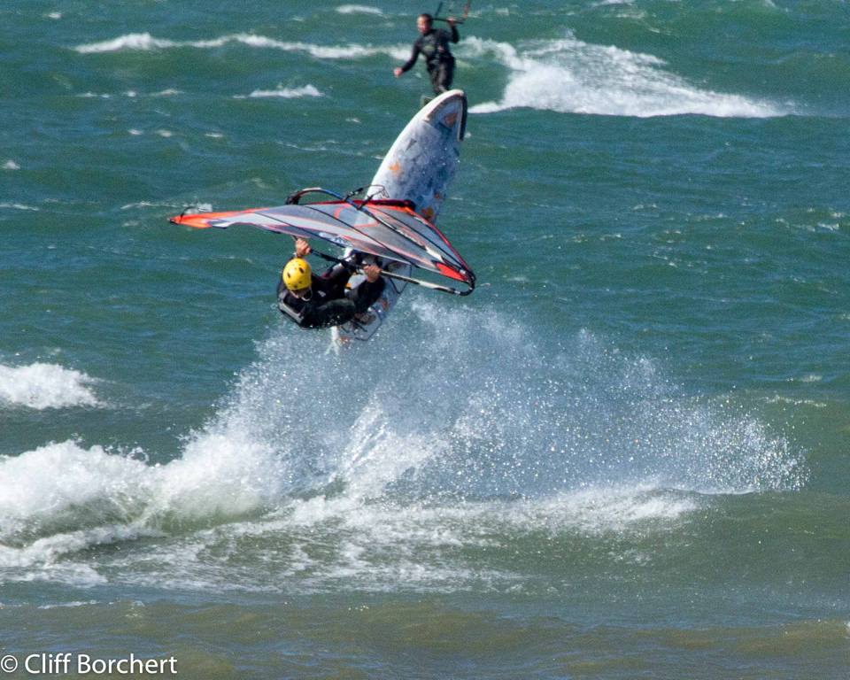
|
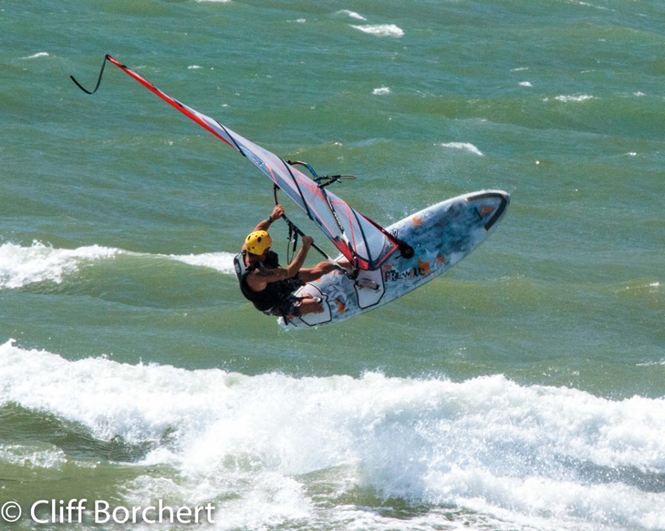
|
|
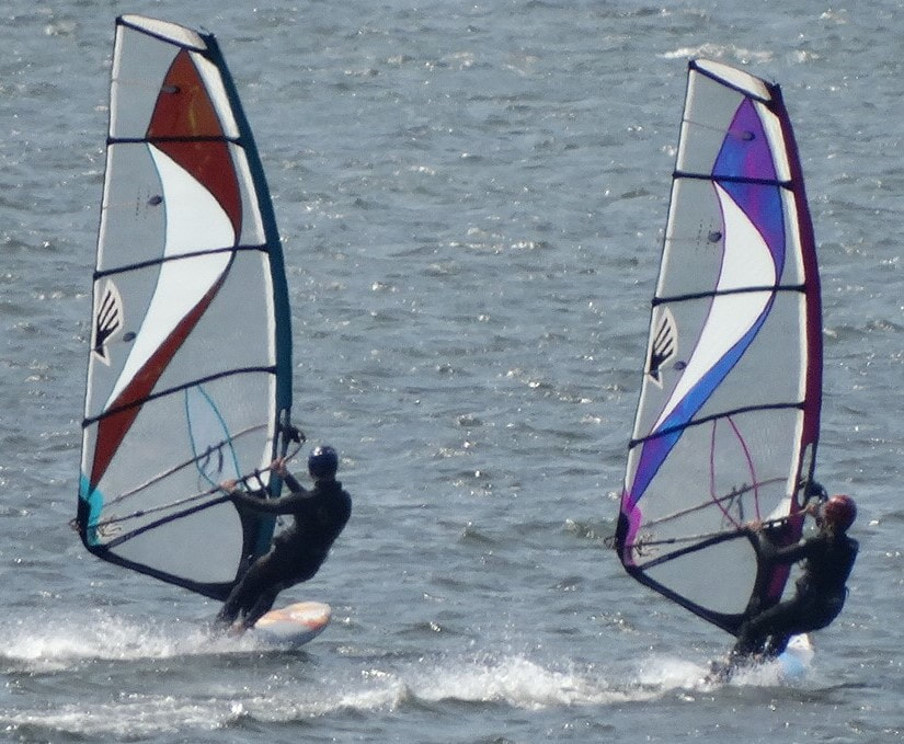
|
Forecast for Wednesday, May 27:
(Written Wednesday, May 27, 8am)
The high pressure still sits in the Atlantic off the east coast, and while it will again be hot, hot, hot, we could see 15-20mph S wind in the Finger Lakes Region in the afternoon. While I don't think it's worth the drive from Buffalo today, keep an eye on those meters if you live in that area. Thursday looks like a better forecast for the Finger Lakes if you need to travel a farther distance.
Forecast for Monday, May 25:
(Written Sunday, May 24, 5pm)
The high pressure remains off the east coast with low pressure up north. On Monday, the best option is early in the morning. It looks like SSW from sunrise until 10am, and then it gets hot. You might score a 15-20mph session on Lake Erie, Niagara River or the Finger Lakes. I'm gonna get up early and take a look at it. I am considering trying out our windsurf foil gear on the Niagara River. It may be the right solution to deal with the gusts. You can read about the foil gear we are using here Our Windsurf Foil Gear and Why.
Forecast for Sunday, May 24:
(Written Saturday, May 23, 1pm)
Deep high pressure coming out of Canada will begin setting up off the east coast of the U.S. bringing several more days of warm temps as it pulls warm air up from the south. Any wind forecasted will be complicated by the bubble effect given the warm air and cold lakes. Sunday, however, has some potential for 15-20mph S wind during the evening in the Finger Lakes Region as the day cools off. It doesn't get dark until almost 9pm, so a session at 7pm is entirely possible as air temps drop. Models are showing the biggest wind after dark, but 15-20mph S wind may still be a possibility before the sun goes down. To understand the bubble effect in more detail you can visit this link https://www.ericthebige.net/weather-forecasting-for-wind-driven-water-sports-in-western-new-york.html
Forecast for Wednesday, May 20:
(Written Tuesday, May 19, 2:30pm)
What a GREAT couple of days we have had with 30mph wind and warm air temps. On Wednesday, the high pressure in Canada will advance farther south and continue to bring ENE wind, but with more sunshine. It's possible that we may see a bubble on Wednesday, but also possible that we will see thermal enhancement. Lake Ontario again looks best, and my forecast is 15-30mph ENE depending on bubble or thermal, with the best wind between 12noon-4pm. Here is a link to a few photos from Tuesday.
Forecast for Tuesday, May 19:
(Written Monday, May 18, 5pm)
High pressure from the north will start to push the low pressure a bit farther south while still giving us a nice pressure gradient here in the GLR. Lake Ontario again looks to be the best place for Tuesday after it delivered a GREAT 30mph session today. Morning looks best on Tuesday with ENE 20-30mph, but it could last well into the afternoon. Lake Erie could also see ENE on Tuesday, but likely of lower magnitude. If you are bored you might want to check out may article Riding Smaller Wave Sails.
Forecast for Monday, May 18:
(Written Sunday, May 17, 5pm)
New guidance now shows that the storm near Florida will not combine with the low pressure in the mid-west. However, the low in the mid-west is gonna stall and continue to bring E wind and rain through Monday. ENE wind will be mostly on Lake Ontario while Lake Erie will be more ESE and lower wind magnitude. Look for 20-30mph ENE in the Olcott area Monday afternoon with rain likely.
(Updated Monday 9:30am: The chance of rain looks significantly less.)
Forecast for Sunday, May 17:
(Written Saturday, May 16, 3pm)
So there's a storm coming up the east coast of Florida and low pressure developing in the mid-west. Looks like the two may combine on Monday and bring some lasting NE wind and rain to the GLR. But the NE wind and rain will start on Sunday mostly as a result of the low pressure in the mid-west. Lake Ontario looks better to me than Lake Erie on Sunday. ENE should start to build in the Olcott area after 10am and the rain may hold off until after 5pm. The peak wind appear to come 12pm-6pm with ENE magnitude 15-25mph. Keep an eye on the rain, and with the warm air temps beware of bubbling.
Forecast for Friday, May 15:
(Written Thursday, May 14, 3pm)
Low pressure will be crossing the GLR on Friday. With it could be a significant amount of rain and hopefully some wind. Most of the models are showing 15-25mph SW wind in the morning and early afternoon with rain, and then a few models are showing a spike in wind magnitude between 2-4pm as rain ends. This spike is not consistent across all models but it could be 20-40mph SW at the peak if it happens. Let's wait until morning to try to narrow it down and see what the rain does also. But there is potential. The models may align better by morning. It looks like the associated cold front comes late around 6-7pm. We could get a long pattern of NE wind starting late Saturday and extending through Thursday, as a tropical storm on the east side of Florida possibly combines with low pressure from the mid-west. Stay tuned!
(Updated Friday, 9:30am: It looks like wind magnitude and direction will kick in right around 1pm as winds veer from SSW to WSW and magnitudes reach 20-35mph. So maybe get there around 12-12:30pm. The first cold front may arrive closer to 4pm and perhaps bring a line of showers with it, but overall rain looks less.)
Forecast for Tuesday, May 12:
(Written Monday, May 11, 3pm)
Low pressure shifting out over Nova Scotia and large scale high pressure over most of the eastern U.S. This will bring some WSW to our area on Tuesday. Look for 15-30mph WSW in the early afternoon. Things will begin to warm up after Tuesday, and the remainder of May looks to have above normal air temps.
Forecast for Monday, May 11:
(Written Sunday, May 10, 5pm)
The low pressure will exit the GLR with a big high pressure system behind it. On Monday, wind will start out N, but after 1pm wind will back to WNW. Magnitude could be in the 15-25mph range WNW on both Lake Ontario and Lake Erie after 1pm. A couple of cold fronts will keep air temps still in the low 40's.
Forecast for Sunday, May 10:
(Written Saturday, May 9, 10:30am)
On Sunday, the WNY area will be positioned in col between steep pressure gradients all around us, so we will likely miss the big wind. However, I think we may still see 15-20mph WSW in the early afternoon with some slightly warmer air temps. This has moderate potential to change by Sunday, so I will update this in the morning if it looks much different.
(Updated Saturday, 7pm: Looking like the timing is 10am-3pm)
Forecast for Saturday, May 9:
(Written Friday, May 8, 4pm)
Low pressure building on the east coast will likely produce bombogenesis overnight and bring a good storm to New England. This will create some really nice W wind in the WNY area for Saturday....BUT....it's gonna be frickin' COLD again. Air temps will barely crack 40 degrees. The best possibility for warmth appears to be Lake Ontario later in the day when it may hit 42 or 43 and the sun might peek out. Wind could be in the range of 25-35mph for a good part of the day.
Forecast for Friday, May 8:
(Written Thursday, May 7, 9pm)
High pressure shifting south out of Canada may bring some WNW wind to Lake Ontario on Friday with air temps not much over 40 degrees. Look for possible WNW in the Olcott area 15-20mph for a good portion of the day.
(Written Thursday, May 7, 9pm)
High pressure shifting south out of Canada may bring some WNW wind to Lake Ontario on Friday with air temps not much over 40 degrees. Look for possible WNW in the Olcott area 15-20mph for a good portion of the day.
Forecast for Thursday, May 7:
(Written Wednesday, May 6, 10am)
High pressure pushes south while low pressure shifts out to the Atlantic Ocean. There will be a mild cold front on Thursday maybe around 12noon. Winds look to favor Lake Erie, and may be 15-25mph WSW starting in the late morning. Perhaps some scattered showers in the afternoon, but maybe sun in the morning. Air temps around 50 degrees.
Forecast for Wednesday, May 6:
(Written Tuesday, May 5, 9:30pm)
Similar set-up to today with high pressure to the north and low pressure to the south. Again, it appears that there will be wind on Lake Erie. Look for 15-20mph NNE wind in the morning with the better wind toward Pennsylvania and Ohio.
(Written Tuesday, May 5, 9:30pm)
Similar set-up to today with high pressure to the north and low pressure to the south. Again, it appears that there will be wind on Lake Erie. Look for 15-20mph NNE wind in the morning with the better wind toward Pennsylvania and Ohio.
Forecast for Tuesday, May 5:
(Written Tuesday, May 5, 9am)
High pressure moving into the GLR from the north, and low pressure to the south. This may induce some decent ENE wind on Lake Erie near Pennsylvania and Ohio. Plus it's sunny today! Look for 15-20mph ENE at the locations mentioned.
(Written Tuesday, May 5, 9am)
High pressure moving into the GLR from the north, and low pressure to the south. This may induce some decent ENE wind on Lake Erie near Pennsylvania and Ohio. Plus it's sunny today! Look for 15-20mph ENE at the locations mentioned.
Forecast for Monday, May 4:
(Written Sunday, May 3, 11am)
Low pressure moves out of the GLR to the east as high pressure mounts to the north in Canada. Winds veer from WSW on Sunday to NW on Monday. Magnitudes look to be 15-25mph NW Monday on Lake Erie and Lake Ontario, and maybe a little greater on Lake Ontario in the Rochester area. Temps in the 50's with perhaps a little sun in the afternoon.
Forecast for Sunday, May 3:
(Written Saturday, May 2, 4pm)
A small low pressure system will pass to our north bringing some wind on Sunday. Probably not anything major, but I think we may see 15-25mph WSW wind on Sunday afternoon. There may be some sun, and temps look fairly warm, so it could be a nice day. I'm very excited about windsurf foiling. Here is a little video of my 4th session CLICK HERE.
Forecast for Thursday, April 30:
(Written Wednesday, April 29, 1:30pm)
The low pressure shifts only slightly eastward, so another day of SE wind on Thursday. Looks like the Finger Lakes Region might be decent again, especially in the morning. Could be 20-40mph SSE wind in the FLR from sunrise until the rain arrives in early afternoon. Air temps warm again, so keep that in mind with regard to bubbling.
Forecast for Wednesday, April 29:
(Written Tuesday, April 28, 1:30pm)
The low pressure will push into our region Wednesday morning, and with it will be some SE wind. However, I think this SE wind may turn SSE in the Finger Lakes Region. Air temps will be in the mid 60's, so bubbling could be an issue, but we may still see 20-40mph wind in the FLR after 11am. Enjoy!!!
Forecast for Tuesday, April 28:
(Written Tuesday, April 28, 12pm)
As the low pressure system approaches from the west we may see some ENE wind on Lake Ontario in the Olcott area. Look for 15-20mph after 2pm.
(Written Tuesday, April 28, 12pm)
As the low pressure system approaches from the west we may see some ENE wind on Lake Ontario in the Olcott area. Look for 15-20mph after 2pm.
Forecast for Sunday, April 26:
(Written Saturday, April 25, 4pm)
Another low pressure system shifting up toward the GLR from our south-west. It looks like it will bring a lot of rain, but also some wind. Lake Ontario looks to have 20-25mph ENE wind for a good portion of the day. Lake Erie may have 15-20mph ENE wind. But probably wet and chilly.
(Updated Sunday, 9am: It looks like both Lake Erie and Lake Ontario will turn more NNE after 3pm, and wind magnitude may ramp up on Lake Erie at that point. Both lakes look to produce 20-30mph wind, but Lake Erie air temps may be several degrees warmer.)
Forecast for Friday, April 24:
(Written Thursday, April 23, 4:30pm)
The low pressure that was in the mid-west today will move east on Friday, just south of the GLR. This will likely induce some ENE wind on Lake Ontario and NNE on Lake Erie in the morning. We may see 15-25mph ENE on Lake Ontario early, and 15-20 NNE on Lake Erie. Again, the issue is air temps, which will barely hit 40 degrees in the morning. However, as the wind drops in the afternoon we should see air temps rise to near 50 degrees, and Saturday is looking warmer too. Maybe 60. Next week appears to push us out of the 30's and closer to the 50's which will feel nice.
If you're bored you may want to read: The Importance of Your MAST
Forecast for Thursday, April 23:
(Written Wednesday, April 22, 9:30pm)
There is a reasonable chance that both Lake Erie and Lake Ontario will see 15-20mph ENE wind in the afternoon on Thursday as some low pressure moves in from the west. Air temps, however, will barely reach 40 degrees.
(Written Wednesday, April 22, 9:30pm)
There is a reasonable chance that both Lake Erie and Lake Ontario will see 15-20mph ENE wind in the afternoon on Thursday as some low pressure moves in from the west. Air temps, however, will barely reach 40 degrees.
Forecast for Wednesday, April 22:
(Written Tuesday, April 21, 5:30pm)
High pressure moving in from the mid-west will start to push out the low pressure over Nova Scotia. Another gradient means another day of wind. Gonna be cold again with air temps barely reaching 40 degrees. If you can tolerate those temps you will likely find W wind 20-25mph on both Lake Erie and Ontario for most of the day with wind magnitude likely decreasing toward evening.
Forecast for Tuesday, April 21:
(Written Monday, April 20, 9pm)
A nice low pressure system is moving through Ontario and Quebec on Tuesday. It should bring some solid W or WNW wind to the GLR along with chilly temps. Lake Ontario looks good with 20-40mph wind after 11am, but air temps will barely get up to 40 degrees. Lake Erie air temps look even colder. Too chilly for me, but I hope you get it. Both lakes will likely start out with WNW wind backing to W wind.
If you're bored you may want to read Know Your Sail
Forecast for Sunday, April 19:
(Written Saturday, April 18, 6pm)
The wind just keeps coming! The low pressure over Hudson Bay is shifting east but extending a nice very trough over the GLR for Sunday. The biggest wind looks to be before 12noon. After that the wind will likely drop as rain move in. Look for SW 20-40mph in the morning on Lake Erie.
Forecast for Saturday, April 18:
(Written Friday, April 17, 4pm)
It's snowing as I type this, but some warmer temps are on the way. Fear not the snow. Low pressure is moving across Hudson Bay currently, with high pressure moving into the states to our south on Saturday. This will set up a gradient over the GLR. It's probably not gonna nuke on Saturday, but air temps should be above 40 degrees with SW wind 20-30mph. Keep an eye out for the sun after noon. Sunday may be a little warmer with the possibility of some stronger wind, so stay tuned.
If you're bored, check out this article Two Different Sports: Large Sails vs. Small Sails
Forecast for Wednesday, April 15:
(Written Tuesday, April 14, 4:30pm)
The big low pressure system from Monday pushes even further north while some high pressure moves closer from our southwest. Air temps are barely going to crack 40 degrees on Wednesday, but if you can tolerate the cold you will probably find 20-30mph WSW wind sometime between 12noon-4pm. Monday was incredible!!! 50mph+ wind and a 2.7m sail on 85 liters. Really fun session!!!
Forecast for Tuesday, April 14:
(Written Monday, April 13, 8pm)
As the low pressure shifts north into Canada we will see more WSW wind on Tuesday. Air temps will be chilly but should reach 40 degrees or a little more between noon-5pm. Magnitudes 15-25mph.
(Written Monday, April 13, 8pm)
As the low pressure shifts north into Canada we will see more WSW wind on Tuesday. Air temps will be chilly but should reach 40 degrees or a little more between noon-5pm. Magnitudes 15-25mph.
Forecast for Monday, April 13:
(Written Sunday, April 12, 10:30am)
Low pressure is moving toward the GLR, and it is intensifying. Monday will start out with S winds that will veer WSW as the cold front arrives. It looks like we may see the cold front approach around 12noon or shortly after. I will try to update this post Monday morning as the time frame becomes more certain. Air temps will be around 60 degrees in the morning, so bubbling is a factor until the cold front pushes through. Be careful though! Winds could ramp up very quickly and with little notice. Caution! After noon we could see wind magnitudes of 30-70mph based on current models. No bullshit! The Finger Lakes Region could get some big S wind in the morning with warm air temps. Of course, bubbling may be a factor with air temps in the low 60's, but wind magnitudes of 25-55mph are possible.
(Updated Monday, 9:30am: Most of the models have scaled back their maximum gust predictions to under 55mph, but the NAM is still saying 60mph+ gusts, so be careful. It looks like direction will veer from S to WSW at around 12noon. Magnitudes could ramp up very quickly. Use caution!)
Forecast for Sunday, April 12:
(Written Saturday, April 11, 4pm)
With this intense low pressure system heading toward the GLR from the southwest, we may see some S wind in the Finger Lakes Region on Sunday 15-25mph. Keep in mind that it will be very warm, so bubbling will certainly be something to consider.
(Written Saturday, April 11, 4pm)
With this intense low pressure system heading toward the GLR from the southwest, we may see some S wind in the Finger Lakes Region on Sunday 15-25mph. Keep in mind that it will be very warm, so bubbling will certainly be something to consider.
Forecast for Saturday, April 11:
(Written Saturday, April 11, 10am)
High pressure to our south and low pressure to our north and east gives the gradient. We should see some WSW on Lake Erie and Ontario between 12noon-4pm with air temps approaching mid-40's and wind magnitudes 15-25mph. Hopefully the sun stays out too.
(Written Saturday, April 11, 10am)
High pressure to our south and low pressure to our north and east gives the gradient. We should see some WSW on Lake Erie and Ontario between 12noon-4pm with air temps approaching mid-40's and wind magnitudes 15-25mph. Hopefully the sun stays out too.
Forecast for Friday, April 10:
(Written Thursday, April 9, 5pm)
Deep low pressure shifting east past New England with high pressure right behind it will bring wind to the GLR on Friday. WNW wind for Friday 20-35mph on both Lake Erie and Lake Ontario. Largest magnitudes in the morning, but it will probably be well below 40 degrees in the morning. Doesn't look like we will see 40 degrees until after noon. However, there should still be enough magnitude after noon for a session. Been a really great season so far. Warm!!!! I read that this Jan-March is the second warmest ever recorded in Buffalo. Enjoy! Been windy nearly every day.
Forecast for Thursday, April 9:
(Written Wednesday, April 8, 11am)
Some low pressure dipping down from Canada will give us a nice pressure gradient on Thursday here in WNY. Looks like wind will start out WNW in the morning then backing W for most of the afternoon. Both Lake Erie and Ontario look good, with magnitudes on Lake Erie in the 20-30mph range and Lake Ontario in the 20-35mph range. Air temps look a little warmer at Lake Ontario where it will probably be around 45 degrees, while Lake Erie might be closer to 40 degrees. Maybe some peaks of sun.
Forecast for Thursday, April 2:
(Written Wednesday, April 1, 4:30pm)
With low pressure sitting off the coast of New England and high pressure in Canada, we will likely see some modest NW wind on Thursday in the Buffalo area. Look for 15-20mph NW wind between 1-6pm.
(Written Wednesday, April 1, 4:30pm)
With low pressure sitting off the coast of New England and high pressure in Canada, we will likely see some modest NW wind on Thursday in the Buffalo area. Look for 15-20mph NW wind between 1-6pm.
